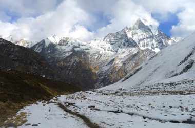
Annapurna Base Camp, the most prodigious trekking route of Nepal offers breathtaking 360 degrees Mountain View, cultural pulchritude and incorporates diverse terrain and wildlife. Easiest Annapurna map trek takes you deep in the region to you can explore the place well. There are 3 popular Annapurna Base camp route.
Tips: You can take our trip to any part of Nepal with travel diary here.
Contents
Why Annapurna map trek?
With the spectacular close up view of the Annapurna range, Machhapuchhre, Dhaulagiri, and Hiunchuli, one can also scrutinize Poonhill, Ghandruk, and Kali Gandaki along the route. 10 to 12 days of the trek to Annapurna has so much to mesmerize you.
All 3 route to Annapurna coincide at Chomrong and follow the same path to the base camp. The trail can either go straight to the ABC or take a detour to Ghorepani Poon Hill or Ghandruk or both. Of course, taking different routes causes plus or minus 3-4 days, but the gratification is worth it. Or you can simply fly in Helicopter.

Map Annapurna Base Camp trek
Among the path, the most popular one is Poonhill- Ghandruk- Annapurna Base Camp trek. It’s a well-designed relaxing trek to explore nature, culture, and biodiversity all at once. For this route, you either fly or ride to Pokhara and take a bus/ jip to Nayapul. A public vehicle drives you only to Nayapul and you can take a jip to Birethanti or even up to Ulleri. Drive from Pokhara to Nayapul takes around 2 to 3 hours and cost you Rs. 150 to 250.
After around two and half hour travel in jeep, you land to Ulleri. You encounter a number of the guest house in Ulleri to crash for a night. Another day is ascending to Ghorepani (Altitude 2800m). It’s a 5 to 6 hours walk that wouldn’t ripe your strength if you go steady. Know how difficult the trek is.
Another day, wake up early and hike to Poonhill for almost an hour to endure the most spellbinding sunrise and panoramic Mountain View. The same day, you can hike to Deurali or Tadepani or even reach Ghandruk. To Tadapni (Altitude 2570m) is 5-6 hours of a walk along the lush alpine forest. Another day, you can spend a relaxing day in Ghandruk to hike up to Sinuwa (Altitude 2300m). OR you can hike to Chomrong from Tadepani which is also 5-6 hours walk.
Now, here you can either Trek to Himalaya (Altitude 2900m) and then Trek to ABC. Or, from Chomrang, trek to Dovan and then to Deurali the other day. Then you can climb up from Deurali to Machhapuchhre base camp and then to ABC.

The descending is trekking down to Dovan or Bamboo (2310m) which is 6-7 hrs walk and Trek to Jhinu (1780m) where you encounter a hot water spring. Finally, trek down to Siwai and drive to Pokhara by local bus or jeep.
Conclusion
Annapurna map trek guide you deep in the Annapurna region.
Tips: You can take our trip to any part of Nepal with travel diary here.


1 thought on “Easiest Annapurna map trek”